
Directions: –

Directions: One Block NE of Paoli Courthouse Square
Directions: Downtown near the Glove Theatre
Directions: Schuylkill Expressway to Lincoln Drive North; right on Carpenter Lane; left on Germantown Ave.
Directions: West of Alamosa on Highway 160; in the Villa Mall; come inside to find us
Directions: In Murdale Shopping Center on Main Street
Directions: From East or West take I-90 to I-79 north to 26th Street exit; take 26th Street east approx. 1 mile or 4 lights; store on right. From South take I-79 to 26th Street exit as above
Directions: Small town, can’t miss co-op on main drag.
Directions: I-85/75 North or South to Carter Center exit; follow signs past Carter Center for two lights to Moreland Avenue; turn right; store on the left after 1st light
Directions: From I-405 N: Take exit 26 for WA-527 toward Bothell/Mill Creek. Turn left onto WA-527 S/Bothell Everett Highway (follow signs for Bothell). Turn left into the shopping center. Bothell PCC is located next to Tully’s. From I-405 S: Take exit 26 for WA-527 toward Bothell/Mill Creek. Use the middle lane to turn right onto Bothell Everett Highway. Turn left into the shopping center. Bothell PCC is located next to Tully’s.
Directions: Corner of 8th Avenue and College Drive
Directions: On 4th Avenue between 6th Street & 7th Street
Directions: –
Directions: LIE to Exit 36; north on Searington road, it becomes Rt 101, continues 2.25 miles to Main St; go left 1.25 miles, store on left
Directions: 209 Main Street, middle of second block west of the bank
Directions: From I-5, take Madison Street east to 16th Avenue; the co-op is on the northeast corner; parking is on the second level above the store; entry from Madison between 16th & 17th Aves
Directions: Main St. betweeen Water St. & Depeyster St.; on street parking in front, lot in back; there is a rear entrance to co-op
Directions: Two blocks east of Hwy 101 on Hwy 20;then south on Benton; corner of 2nd & Benton
Directions: Centrally located on Newport Road in New London, a quick drive from I-89
Directions: North on I-5: Take the NE 65th Street exit (Exit 171). Turn left at stop. Merge onto 8th Avenue NE and then merge onto Weedin Place NE. Take left on NE 71st St. South on I-5: Take NE 65th St exit. Turn right at stop sign onto NE 71st St.
Directions: 1/2 mile east of the “Big Chicken” near the intersection of Hwys. 120 & 41.
Directions: –
Directions: I-94 & Hwy 280 to University Ave; turn right to Raymond; left 2 blocks to store on right
Directions: Call for directions
Directions: Off of I-80 take 9th St. downtown; continue on 9th past “A” Street; next major street is South; turn left, co-op is on the left side between 16th & 17th

Directions: Exit 5th Avenue off I 670; east on 5th Avenue; first traffic light right into Cassady; 1/4 mile to the left
Directions: Located in the Parkway Shopping Center at the corner of Apalachee Parkway (US27 S.) and Magnolia; one mile east of the Capital.

Directions: On Main Street next to Walgreen’s
Directions: Traveling North or South on NYS Thruway (I-87/287): take Exit 14A; take 1st exit (Red Schoolhouse Road); turn right on schoolhouse Rd; go to end; turn left on Chestnut Ridge Road (Rt 45); proceed .2 mile to co-op on the right. Traveling North on the Garden State Parkway: take Exit 172; turn left on Grand Ave; at the first traffic light turn right on Chestnut Ridge Road; 1.8 mile to Coop on the left.
Directions: From downtown Corvallis take Harrison St. west; at 29th St. take a right; co-op on the corner of 29th & Grant Avenue
Directions: Exit #26 on I-91; go west Rt 2 for 10 minutes to Shelburne Falls
Directions: Located north of the University of Texas on Guadalupe Street • Opening a second Location: 4001 South Lamar, Austin, TX 78704
Directions: From the East – Exit 23 NYS Thruway to 787 N. to 90 W. to Exit 5 (Everett Road); left onto Everett Road; left on Central Avenue for 5 blocks; on the right behind Family Dollar. From the West – Exit 24 N.Y.S. Thruway to 90E to Exit 5 (Everette Road); turn right (same as above)
Directions: –
Directions: In back of Roosevelt Center.
A full-service grocery store.
(Photo credit: Michael Conway.)
Directions: – KCFC is on the corner of 5th and Park Avenue in downtown, Bremerton, WA
Directions: Just north of East Michigan Ave/I-94 business loop on Harrison
Directions: –
Directions: –
Directions: –
Directions: Take 27th St. Exit North to 1st Ave. No; left on 1st Ave. No.; 4 blocks to 31st No.; 1 block north to 2nd Ave No; store is on the right
Directions: 1 block north of the Central/Lowry intersection in NE Minneapolis
Directions: In downtown Petoskey on Mitchell Street between Emmet St & Petosky St
Directions: From I-25, go north on St. Francis to W. Alameda; go west, 2 blocks on the right.
Directions: (Mail: PO Box 280)
Directions: Downtown or Business District the co-op is next to the Christian Science Reading Room and across from the Village Hall Parking Lot
Directions: (Mail: PO Box 1631)
Directions: Exit #26 on I-91; go east 1 mile into center of Greenfield
Directions: West on Alameda, past Coors Blvd left at Cottonwood Corners Shopping Center
Directions: In north addition; next to Art & Learning Center
Directions: Located on the corner of Hwy 70
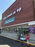
Directions: (visitors can not shop – members only; “Everyone Welcome to Join”)
Directions: One block west of Arcata Plaza, at 8th & I St.

Directions: On First St between A St. & B St. in the Historic Railroad District

Directions: –
Directions: Rte 10 north (Lyme Road); opposite fire station (5,000 square foot food market)
Directions: At the junction of Main St. and Northwestern; downtown Ames
Directions: (co-op provides organic produce, grains, nuts, seeds, olive oils, coconut oils,+++)
Directions: From I-40, Exit Wendover Avenue E, exit right on Cridland Road; turn right at stoplight onto North Eugene Street, go through stoplight at Fisher Avenue, 2nd building on left
Directions: Rt 12 (6th Avenue) to Main St; north 4 blocks on Main St to 125 on east side of st.

Directions: Located on Riverside, just north of Barnett Road
A full-service grocery store.
Directions: Take the Dale St. exit off I-94; take Dale South 4 blocks to Selby; continue through Dale-Selby intersection; turn right into parking lot
Directions: –
Directions: In Houghton Village Shopping Center
Directions: Corner of 4th & B Streets
Directions: Rt 89 to Exit 8 (Montpelier); merge onto Memorial Drive; turn left at Main St; turn right on Stonecutter’s Way; co-op on the right
Directions: On the west side of town at the intersection of Hwy 55 & Westview Dr. Sharing the building with MGM Liquor.
Directions: –
Directions: In Riverwest, corner of Fratney & Clarke
Directions: From Hwy 35: take Lake Ave exit up the hill to 4th St.; take a right; store is on the corner of 4th Street E. and 6th Avenue
Directions: 4 miles north from I-89 (exit 18) on Rt 120; store is on right next to Co-op Service Center and gas station
Directions: Just South of downtown Frederick in Evergreen Square shopping center
Directions: 65 miles north of Seattle, I-5 to Kincaid Exit #226, turn west, go to 2nd light, turn right onto 3rd St., go approx five blocks to next light; Co-op is on your left
Directions: Outer Sunset District on Judah between 44th & 45th Avenues: hand painted mural above store!
Directions: –
Directions: Located across from the Cambridge Hotel. Parking in back with both front and rear entrances.
Directions: Going north on Highway 97 or Hwy. 20 from the east into Tonasket; turn onto 4th St; end of block, on left; Barter Faire info line: 509-486-2173
Directions: I-90 to downtown Buffalo; on Elmwood & Lancaster Avenue in Elmwood Village District
Directions: –
Directions: Corner of 16th & Broadway
Directions: From East: From I-94, take Riverside Ave Exit; left on Riverside Ave; right on Franklin Ave. From West: From I-94 take Riverside Ave Exit; right on 26th Ave. S.; left on Franklin Ave.
Directions: Turn north at the stop light; 1/2 way down the block on west side of the street
Directions:
Directions: –
Directions: Pickering Place shopping center. PCC is on the left.
Directions: Directly across the highway (Main Street) from the Skyline Mall; next to Albert Lea Seed House
Directions: –
Directions: I-5, exit 107, head west on Pacific; corner of Lansdale & Pacific
Directions: From I-40, continue south on Hwy. 132, turn left onto Oleander Drive (Hwy 76);store is approx 1.5 miles down on left side of road
Directions: –

Directions: Heading north on Rte 1 take 1A Belfast Business District; approx 1 mile down on right. From Augusta take Rte 3 east to the major downtown red light in Belfast; take a right; 200 feet on left
Directions: –
Directions: On corner of Sims Way & Kearney St.
Directions: Near the Art Center
River Valley Co-op is a full service, community-owned food cooperative, specializing in fresh, local and organically grown groceries, prepared foods, wine and beer, wellness, and bulk items. Everyone is welcome to shop, co-op ownership is not required.
Open daily 8am – 10pm at 330 North King Street, Northampton, MA.
Directions: On Rt. 1 north of town center
Directions: On Baltimore Avenue in lovely West Philly
Directions: Dining hall mezzanine of Purchase College
Directions: Located on the corner of St. Claude and St. Roch in the New Orleans Healing Center

Directions: Enter Decorah via Hwy 52 or Hwy 9, then come downtown; find Water Street which is the main street; look for the intersection of Water St. & River Street; two blocks east of Vesterheim Museum
Directions: Head east of WA-520; take slight right onto Avondale Road exit; Avondale Road exit becomes Avondale Road NE. Turn left into parking lot before 116th street intersection.
Directions: –
Directions: –
Directions: 2 miles north from I-89 (exit 18) on Rt 120; store is on right at top of hill in the Centerra Resource Park
Directions: Just south of Forest Hills MBTA station on Washington Street
Directions: From Hwy. 49 exit at the Dorsey Drive off ramp; turn left on Dorsey and continue straight through the Main Street traffic light, where the road becomes Sierra College Drive; the store is 1/4-mile up the hill on the left, just past the traffic circle and Sierra College.
Directions: From Hwy 51 (39), take Business 51 to 4th Avenue; turn west (right from N); go 3/4 mile to the corner of 4th Ave and 2nd Street; across from St Peters Church and Pisarsk/Dzikoski Funeral Home (open to the public)
Directions: From Exit 2 of I-89 take Rt 14 north to intersection of 110; left over bridge into town; halfway down block
Directions: Rt 376 to Exit 7 (Edgewood), veer left off the exit (toward Regent Square) and then turn right onto Braddock Avenue; turn left at the 4th light (2 miles) onto Meade Street, the co-op and parking area are on the left (lower level of the Factory building)
Directions: 101 Freeway North; exit Los Carneros & turn left; proceed all of the way to El Colegio Road & turn left; turn right on Camino Pescadero; pass two stop signs; turn left on Seville Road
Directions: I-25 to Menual/Candelaria exit; West on Menual, just past stoplight at Broadbent
Directions: From Hwy 99 take Hwy 32 west (Hwy 32 turns into 8th St or 9th St if going east on Hwy 32), store is on the corner of 8th & Main Streets
Directions: Located just north of downtown on Business Rt 1 (Upper Main Street); across the street from Yellowfront Grocery Plaza
Directions: Exit 53 off of I-26 (Upward Road exit); take Upward Road to Spartanburg Hwy (176); turn right; at 4th stop light turn right left